Future trail would expand Leesville accessibility

0
302
Looking south, the future intersection of the trail (along the pre-cleared easement) and Country Trail, as seen in this Oct. 2011 Google Earth screenshot. The parking lot for the library is about 50 yards west (to the right).

For Leesville community members living in neighborhoods to the south of the library, park and school complex, a new route to the area’s public facilities may soon begin construction.

A new 10-foot-wide path could connect Country Trl., which borders directly with Leesville Park and Library and Leesville Elementary School, and Whitley Drive, a small cul-de-sac off of Sprague Rd. with proximity to Hilburn Dr. and the North Forest and Breckenridge neighborhoods.

The paved trail would stretch about a third of a mile, following the cleared route of an easement on its northern half before embarking into the woods when approaching the residential area. Three noteworthy plants – Pennsylvania sedge grass, Christmas fern and Fringetree – have been identified along the route.

The current satellite of the Leesville Park and the surrounding roads, with the trail path outlined in dashed red. More trails are planned for the years ahead to circle through the currently undeveloped green space.

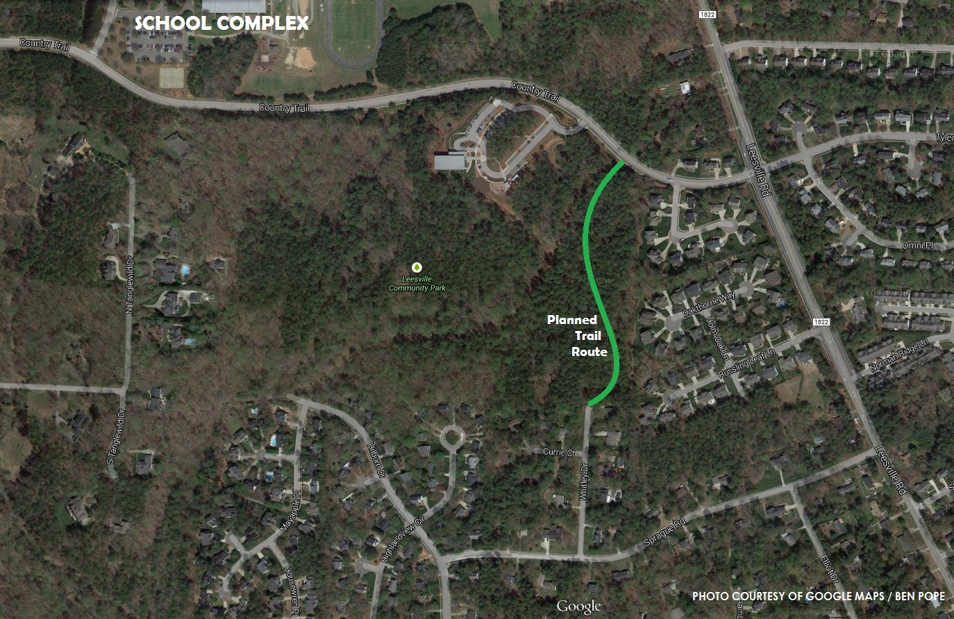
According to the project’s information page on the City of Raleigh website, “This trail will provide an alternate route into the park and to Country Trail for pedestrians, bicyclists, and others coming from the neighborhoods south of Leesville Park.”

For residents to the south, access to the park and three schools can be limited. Those in neighborhoods in the Lake Lynn, Pleasant Valley and Grove Barton areas are forced to travel on either Leesville Rd. or Pinecrest Rd. heading north.

Looking north, the future intersection of the trail and the dead end of Whitley Dr., as also seen in this Oct. 2011 Google Earth screenshot.

While a Hilburn extension to Pride Way is planned as a future traffic-focused project, the new trail will provide non-vehicle travelers with a convenient connector through nature.

LEAVE A REPLY

Please enter your comment!
Please enter your name here

This site uses Akismet to reduce spam. Learn how your comment data is processed.